
Tracing a Bristol Street Trail
A Bristol street directory search works best as a linked record trail. The assessor and GIS can identify a parcel and show an owner or mailing field. The voter lookup may show a public registration result, while an old directory may place a named person on a street for one year. None of those sources is a complete household list. The aim is to tie one address to the right parcel, then compare records that answer different questions.
- Start with Vision. Run the address, owner, account, MBL (map, block, lot), or parcel ID (PID) in the Bristol property search. Save the result spelling, account, map and lot fields, and any visible Street Listing or Sales Search result.
- Open the parcel in MapXpress. Use the Bristol GIS property search to compare House No, Street, Owner or Co-owner, and Account. Then inspect the parcel on the interactive map when adjacent lots or map layers matter.
- Check the public voter route. Try the Connecticut voter lookup and route local questions to the Bristol registrars. A public match is limited by current privacy rules and does not supply a complete block roster.
- Verify the legal trail. Use the Town Clerk's land-record instructions and the linked RecordHub index to search the owner as grantee, the seller as grantor, the property description, or a book and page.
- Reach backward through local history. Ask the Bristol Public Library History Room for the street section of the appropriate directory, newspaper index, map, or house file. Record the volume, year, page, exact spelling, and source type instead of treating a historical listing as a current fact.
The order matters. An address string can point to a mailing destination, a parcel situs, or a civic account. The parcel and legal description give the street search an anchor before names are compared across systems.
Bristol Street Records at a Glance
The Bristol street directory landscape is split among town, state, library, and map custodians. Connecticut has no modern county clerk for ordinary local land records, so a Hartford County request must be routed to the Bristol Town Clerk, assessor, registrars, library, or the court or state office that actually holds the record.
| Street-keyed source | Keeper | What it can show | Access and limits |
|---|---|---|---|
| Assessor card and grand list | Bristol Assessor | Owner display, mailing and situs, value, assessment, exemptions, permits and visits on some cards | Vision public search; current data, with no public online start year posted |
| Parcel GIS | Bristol GIS and MapXpress | Parcel polygon, MBL and account, owner, location, mailing, acreage, zoning, land use, and map layers | Public search and map; parcel maps updated February 2026, property data updated nightly |
| Recorded deeds and maps | Bristol Town Clerk and RecordHub | Grantor, grantee, instrument, recording date, book and page, legal description, maps, and images | Subscriber images are stated from March 22, 1787; office or mail copies are $1 per page and maps not online are $2 |
| Voter roll | Bristol registrars and SOTS | Public registration information and status fields that remain visible under privacy rules | State lookup and local registrar route; public street and block behavior was not fully verified |
| Permits and code files | Bristol Building and Code Enforcement | Addressed work, complaint or permit status, and owner or requester fields when public | Online search after account creation and a public department computer; historical coverage was not posted |
| Directories and newspaper indexes | Bristol Public Library History Room | Name-to-address entries, reverse sections where present, obituaries, transfers, house stories, and civic changes | Directories run 1884-1991; Bristol Press coverage has 1871-2006 and 2012-present runs with gaps to check |
Use the table as a chain, not a stack of duplicate owner names. The assessor supplies a lead, GIS checks the parcel and its surroundings, the Town Clerk verifies an instrument, and library sources add dated people and street context. A record may be public while one field inside it remains restricted or absent.
Searching Bristol Parcels by Address
MapXpress is the most direct Bristol route for a street-by-street pass. Its public form accepts an Owner or Co-owner, House No, Street, and Account. The Street selector includes All Streets and a live list of Bristol streets. The account value can connect a visible address to the parcel record even when a mailing address or owner spelling changes. The interactive map then adds parcel information, address labels, aerial basemaps, layers, and an AbutterDetail path.
| Portal field or control | Entry format | Why it helps a street search |
|---|---|---|
| MapXpress Owner / Co-owner | Text field | Tests an owner spelling before the address is known; compare the returned parcel and location. |
| MapXpress House No | Text field | Narrows a number within the selected Bristol street and keeps the street string visible. |
| MapXpress Street | Selector with All Streets | Pairs a house number with the portal's current street list instead of relying on a typed variation. |
| MapXpress Account | Text field, with an example account format shown | Cross-checks a parcel when the situs, owner, or mailing address has changed. |
| Vision search mode | Address, Owner, Acct#, Mblu, PID, or All | Offers several routes into the assessor record; text modes take one criterion and Mblu uses segmented map, block, lot, and unit fields. |
| Vision Street Listing and Sales Search | Linked search modes | Supports a whole-street review or a sales comparison after the first parcel result is found. |
The Bristol GIS page reports approximately 21,972 parcels. That number is a capture-time scale marker, not a promise that every parcel has the same fields or that a visible polygon proves present occupancy. Keep the parcel ID, capture date, and source layer with any notes.
The MapXpress interactive map shows how a parcel search can move into layers, parcel information, and measurement tools.
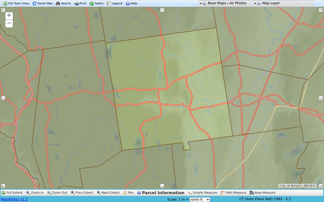
The map is useful for orientation and comparison. A boundary on screen is not a survey, and the February 2026 parcel-map date does not give every overlay the same vintage.
A Bristol Parcel With Two Address Roles
Bristol street directory work needs a firm distinction between a situs address and a mailing address. The situs is where the parcel is located. A mailing field is where notices or tax material are sent. Those strings can be different, and a civic or business mailing address should not be mistaken for a home location. Preserve both values with the field labels that the source uses.
The official sample field card for 120 Memorial Boulevard makes the point unusually well. The parcel record ties the civic site to account 0243060 and MBL 30-114. The Vision card shows Vision ID 2759, a City of Bristol owner, a school-use field, a 1921 year-built field, and a City Hall mailing address at 111 North Main Street. Its GIS comment notes a combined abandoned portion of Willis Street and cites map RD1903. Those details demonstrate why a street search must follow parcel and map references instead of copying a single address string.
- Parcel
- A mapped unit of land identified by fields such as account, MBL, map, block, lot, or unit.
- Situs address
- The physical location assigned to the parcel. It can differ from the owner's mailing address.
- Plat
- A recorded map that shows lots, streets, easements, rights-of-way, or parcel changes.
- Criss-cross directory
- A reverse directory that starts with a street and number, when a volume includes that section, instead of starting with a surname.
- MBL or map-lot
- A map, block, lot, and unit reference used to identify a parcel apart from its mailing address.
The Bristol assessed-value guide connects the assessor search to sales, street listing, exterior measurements, land size, and construction details.
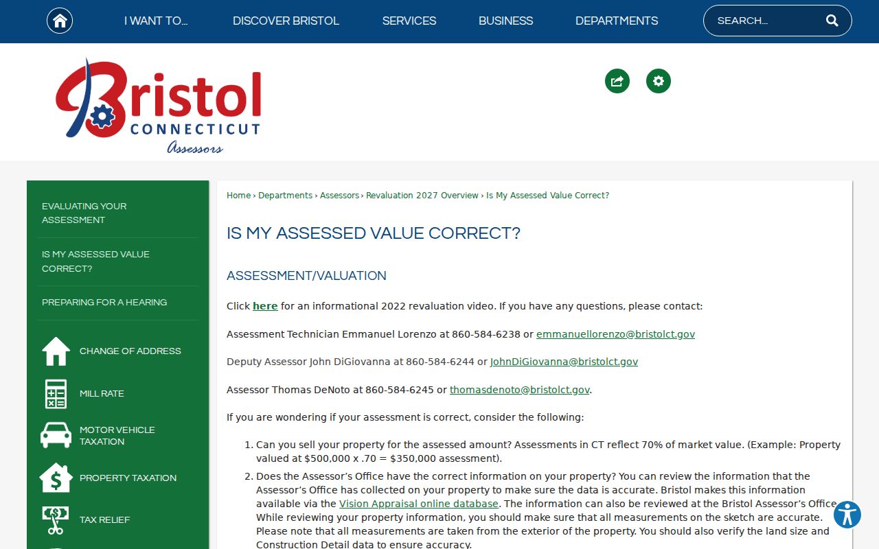
That guide is a prompt to compare fields, not a substitute for a recorded instrument. When Vision, GIS, and a deed disagree, keep the disagreement visible and ask the responsible office which field controls the question at hand.
Bristol Vision Fields for a Street Search
Vision Government Solutions supplies the assessor side of the Bristol street directory. Address, Owner, Acct#, PID, and All are text modes. Mblu breaks the map and lot reference into Map, Map Cut, Block, Block Cut, Lot, Unit, and Unit Cut. The form showed no required-field marker, so one clear criterion is the sensible starting point. The visible navigation also includes Street Listing, Sales Search, Map, Feedback, Back, and Home.
Bristol's assessor guidance says property is assessed at 70 percent of market value and points users toward sales search, street listing, exterior measurement checks, land-size checks, and construction details. An assessment is a value and administrative record. It is not certified title, and an owner display does not establish who is physically present at the parcel. The sample field card also separates property location from owner mailing information.
Bristol Assessor
Assessor office and Vision route
860-584-6240
Use for assessment fields, card questions, and a conflict that cannot be resolved from the public form.
Bristol Town Clerk
Town Clerk contact and records office
860-584-6200
Land instruments, maps, municipal records, and the local recorder route remain a town function.
Bristol GIS
MapXpress parcel search
Public map and parcel viewer
Property information is reported as updated nightly; parcel maps were reported updated in February 2026.
For a whole-street pass, begin with Vision Street Listing, save the result count and visible identifiers, and then open each candidate in MapXpress. The paired captures are stronger than a bare name search.
Reading Bristol GIS Layers and Abutters
The Bristol interactive map supports parcel selection, address labels, aerial basemaps, layer switches, print and help controls, and Simple, Path, and Area Measure tools. Available layers include zoning, wetlands, flood areas, utilities, sewer, streetlights, historic districts, and parcel labels. Orthophotos are available for 2023, 2016, 2012, and 2010, alongside a planimetric base. An orthophoto is an aerial image corrected so map features can be compared more consistently with parcel lines.
For an adjacent-property question, select Parcel Information, open the parcel result, and use the AbutterDetail or adjoining-parcel interaction. Save the MBL or account for each parcel before comparing owner, location, mailing, acreage, zoning, land use, coordinates, and source or edit fields. The map is a research aid, not a survey. Easements, rights-of-way, condominium units, and recent edits may require the recorded map or a survey from the proper custodian.
The Bristol parcel-layer metadata shows the machine-readable field set behind the public map, including location, street, house number, account, map, block, lot, unit, mailing fields, sale and appraisal fields, coordinates, and edit information.
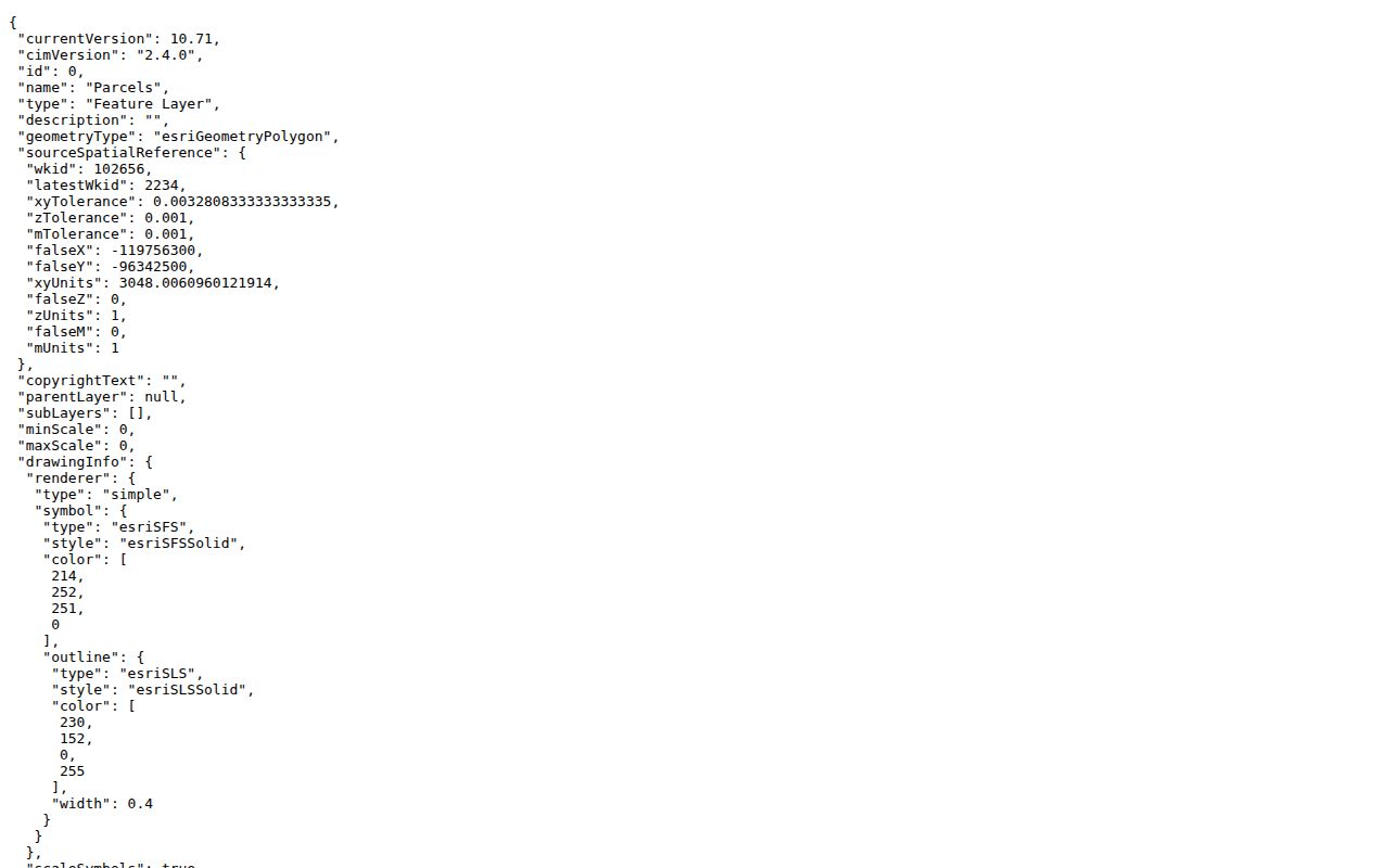
A REST field, meaning a machine-readable data response, or polygon is still tied to a source and date. Keep those labels when a street result is used for a property-history question, especially because the public GIS reports nightly property edits.
RecordHub Deeds Along a Bristol Street
The Town Clerk is Bristol's recorder because Connecticut has no ordinary county recorder. Bristol's land-record page reports a transition to Cott RecordHub on May 4, 2026. The index tutorial shows All, Name, Property, Book/Page, date ranges, Expanded Search, grantor and grantee fields, document type, property or parcel description, book and page, scanned-page counts, and an image viewer. Search the present owner as grantee, then search the prior seller as grantor to move backward through a parcel's recorded chain.
| Result field | What to record |
|---|---|
| Grantor and grantee | The parties transferring or receiving an instrument. Test initials, middle names, entities, and spelling variants when the chain changes form. |
| Recording date and document type | The date entered into the public record and the kind of instrument, such as a deed, release, lien, easement, or map. |
| Property or parcel description | The wording that connects the instrument to a lot, map, address, or legal description. |
| Book and page | The durable citation for an image or an office copy, even when a modern street number later changes. |
| Scanned pages and image viewer | Whether an image appears online and how many pages may need to be read or ordered. |
RecordHub subscriber access is stated to reach Volume 1, beginning March 22, 1787, but index behavior, image quality, and availability can vary by record. Non-subscribers can request copies from the Town Clerk in person or by mail at $1 per page. A map not available online can be requested for $2. Preserve the book, page, legal description, and map reference when a result matters.
When the web route does not answer the question, the office and mail channels still matter. The Town Clerk is at 111 North Main Street, and the public contact route is townclerk@bristolct.gov. A request should state the town, property description, names, date range, and the exact copy or map sought.
Bristol Street Names Through Maps and Time
Bristol's street directory history crosses several civic eras. Bristol was established from Farmington in 1785, Burlington was taken from Bristol in 1806, and the city and town became coextensive in 1911. An old record may therefore use a town description, a village label, or a route name that does not match a current city search. Forestville is a Bristol locality, not a separate current municipality.
No official public table of every Bristol renumbering or street-name change was located. A careful address trail uses a map ladder: old deed description to recorded map, assessor tracing or note, city-directory street section, Sanborn or topographic sheet, the 1802 Survey of Bristol Turnpikes, and a current GIS capture. Search the Bristol Press index for a civic change when the street string still does not line up.
The 120 Memorial Boulevard GIS comment is a useful Bristol-specific clue because it preserves a combined abandoned portion of Willis Street and cites map RD1903. That does not supply a complete renumbering history. It gives the researcher a term to carry into the Town Clerk map index, library materials, and earlier records.
Note: When an old street number fails, keep the original wording, parcel identifiers, map reference, and search date together instead of silently modernizing the address.
Permits, Voters, and a Street's Currentness
Bristol's permit and search page says online applications and public search become available after account creation, with online payment and a public computer at the department. Structural, plumbing, mechanical, electrical, demolition, conversion, and related work may require a permit. Review can take up to 30 days, but the live portal's fields, fees, and historical coverage were not visible in the research capture. A blank permit result is not proof that no work occurred.
For civic registration, the state lookup and Bristol registrars are the documented routes. Connecticut's Centralized Voter Registration System, or CVRS, is maintained by local registrars and is updated within 60 days after elections or primaries. Current rules limit public date-of-birth display to the birth year. State voter-roll guidance explains maintenance and removal processes, but the public street and block output was not fully field-verified. Use the registrar contact for a question about a local roll rather than inferring a person's status from a non-match.
If a public record is not exposed in a portal, Connecticut's Freedom of Information Act supplies a general request route, subject to the record's specific exemption and access rule. The state's FOI copy-fee regulation gives the fee framework for copies and scanning. Describe the custodian, address or parcel, record type, date range, format, and preferred delivery. The request goes to the office that holds the record, not to a county clerk that Bristol does not have.
Note: A current street result can change after a nightly data edit, election update, new filing, privacy action, or address correction.
Limits of a Bristol Street Directory
A Bristol street directory cannot show every person connected with a parcel. Public property systems generally do not list utility customers or a complete household, and a protected voter address may be withheld or substituted. A deed names parties to an instrument, not every person who used a building. A directory entry proves that a name was printed at an address for a particular time, not that the person remains there.
Keep the roles separate: owner, mailing recipient, parcel situs, directory-listed person, voter result, permit party, and historical mention are different evidence labels. The Department of Motor Vehicles address system is not a substitute source, and court or vital records may expose only the fields permitted by their own rules. When a record is important, verify it with the named custodian and cite the source date.
Lawful personal use. Bristol address and street records are appropriate for genealogy, house history, civic research, and other lawful personal purposes. Do not use a result to stalk, harass, intimidate, or harm another person, and respect a confidentiality or privacy designation.